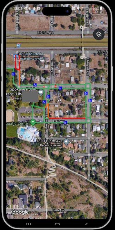
Google Maps Accessibility filter
Team members: Timothy Gant, Miressha Huff, Jen Roberts, Vlad Kozlov
view project hereThis UX design project was made in fall of 2021, in my Senior Capstone class. We were tasked with mapping an area surrounding the Liberty Park branch of the Spokane Public library system and subsequently relaying the accessibility of the area in a user experience of our choosing. At the time, Google Maps did not have an accessibility filter, and would not until May of 2024. Thus, the route we chose to pursue was creating a Google Maps accessibility filter of our own.
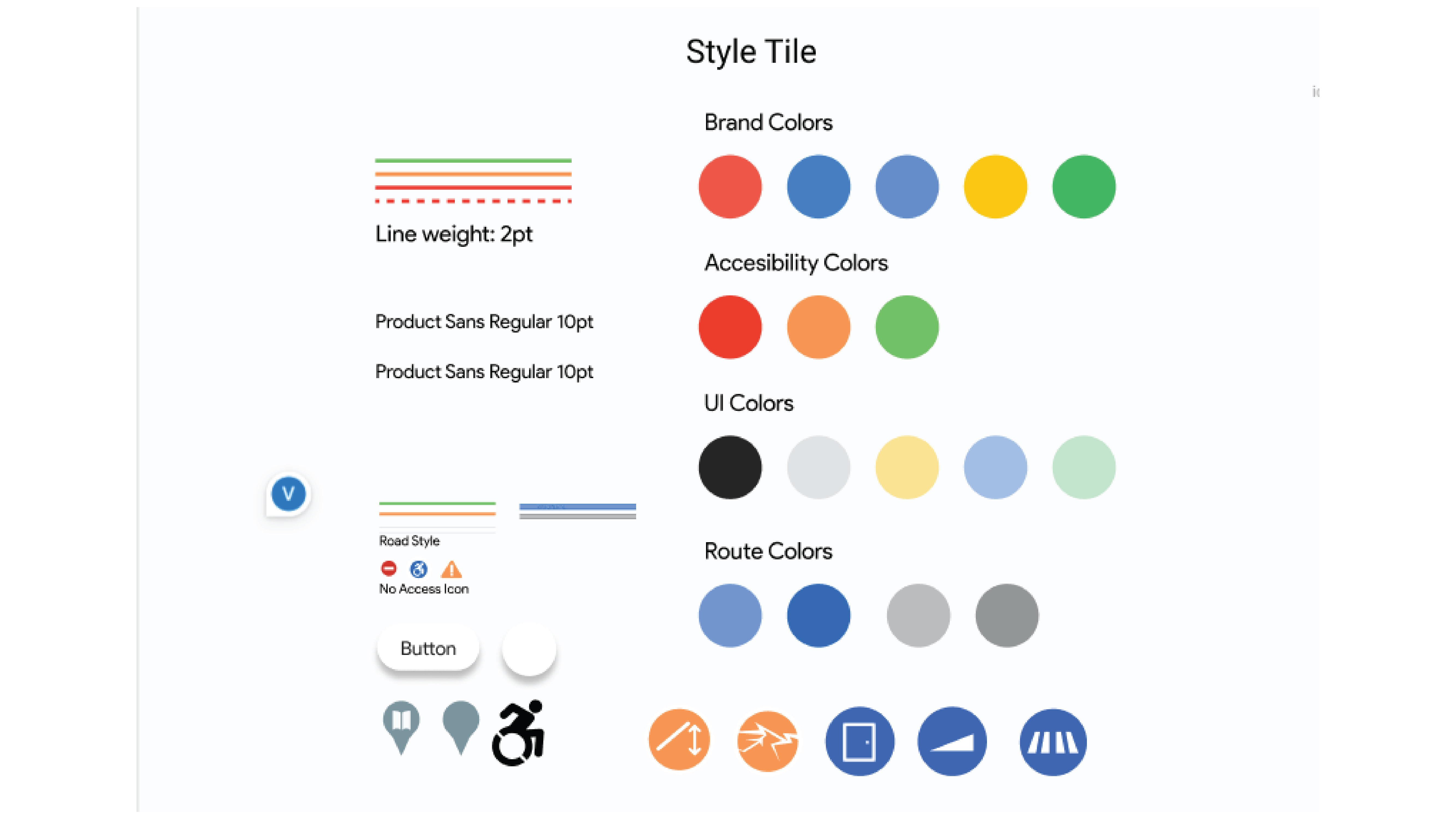
Style designs
Before converting the information gathered while surveying the library, we needed to develop a style in line with Google, including implementing ADA colors and developing six unique notification icons. Additionally colors were designed to still be distinguishable regardless of red or green colorblindness, by slightly editing the hues the red will always be most vivid, and green least.
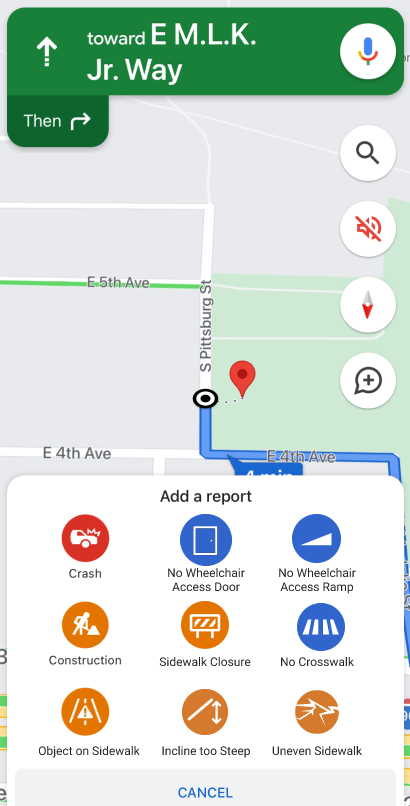
The Final touches
One of the final touches was to implement the ability to report accessibility issues the same way you could report a car crash on maps. An active report would transform the color of the route similar to how reports currently change road colors based upon traffic conditions